
Big plus one for the @UkNatArchives research guides - they're my go to for any new topic - obviously, for place-based work if there's an @VCH_London entry available (and we know that the east of England is a gap) then that's a useful place to start. Many are on @bho_history 1/x
@KYPWestEngland (Devon, Som. Wilts, Bristol, Glos): https://t.co/7jvZguClsa
Norfolk Historic Maps: https://t.co/rAQCdP4it8
More from Government


You May Also Like

👨💻 Last resume I sent to a startup one year ago, sharing with you to get ideas:
- Forget what you don't have, make your strength bold
- Pick one work experience and explain what you did in detail w/ bullet points
- Write it towards the role you apply
- Give social proof
/thread
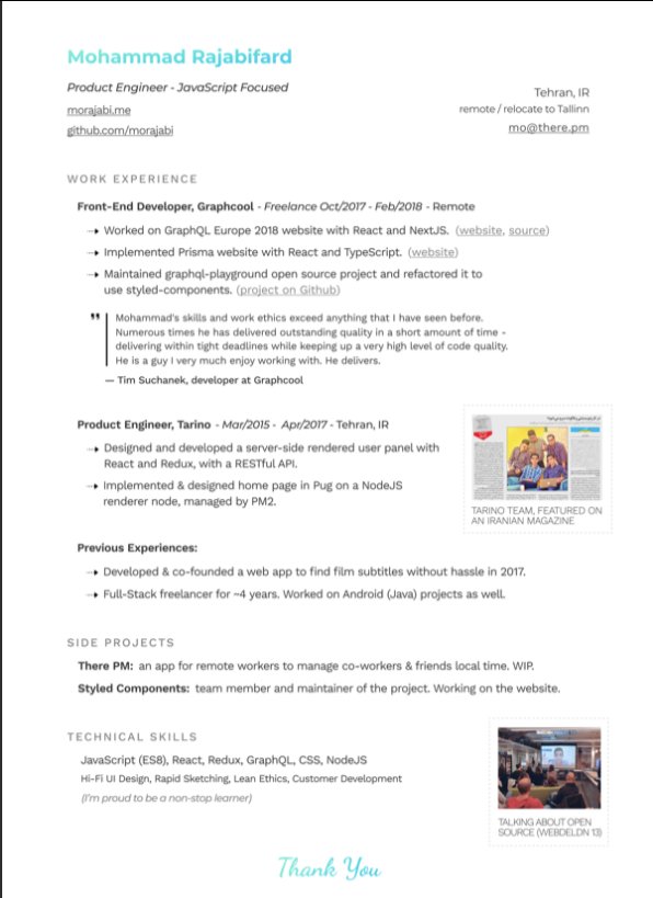
"But I got no work experience..."
Make a open source lib, make a small side project for yourself, do freelance work, ask friends to work with them, no friends? Find friends on Github, and Twitter.
Bonus points:
- Show you care about the company: I used the company's brand font and gradient for in the resume for my name and "Thank You" note.
- Don't list 15 things and libraries you worked with, pick the most related ones to the role you're applying.
-🙅♂️"copy cover letter"
"I got no firends, no work"
One practical way is to reach out to conferences and offer to make their website for free. But make sure to do it good. You'll get:
- a project for portfolio
- new friends
- work experience
- learnt new stuff
- new thing for Twitter bio
If you don't even have the skills yet, why not try your chance for @LambdaSchool? No? @freeCodeCamp. Still not? Pick something from here and learn https://t.co/7NPS1zbLTi
You'll feel very overwhelmed, no escape, just acknowledge it and keep pushing.
- Forget what you don't have, make your strength bold
- Pick one work experience and explain what you did in detail w/ bullet points
- Write it towards the role you apply
- Give social proof
/thread
"But I got no work experience..."
Make a open source lib, make a small side project for yourself, do freelance work, ask friends to work with them, no friends? Find friends on Github, and Twitter.
Bonus points:
- Show you care about the company: I used the company's brand font and gradient for in the resume for my name and "Thank You" note.
- Don't list 15 things and libraries you worked with, pick the most related ones to the role you're applying.
-🙅♂️"copy cover letter"
"I got no firends, no work"
One practical way is to reach out to conferences and offer to make their website for free. But make sure to do it good. You'll get:
- a project for portfolio
- new friends
- work experience
- learnt new stuff
- new thing for Twitter bio
If you don't even have the skills yet, why not try your chance for @LambdaSchool? No? @freeCodeCamp. Still not? Pick something from here and learn https://t.co/7NPS1zbLTi
You'll feel very overwhelmed, no escape, just acknowledge it and keep pushing.


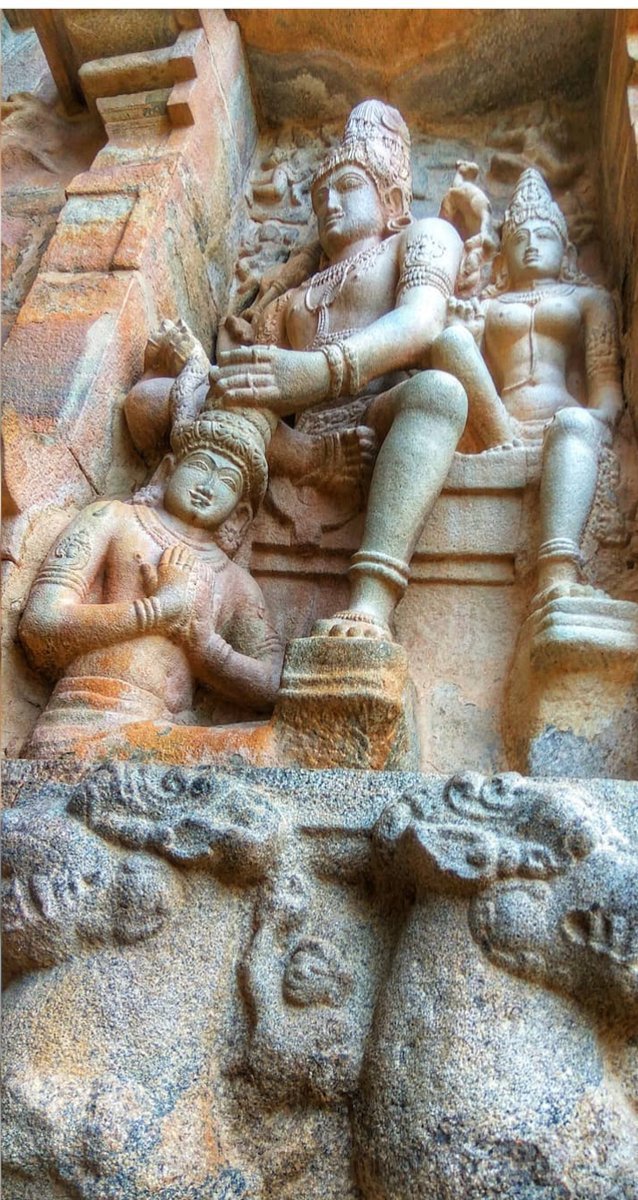
#sculpture #story -
Chandesha-Anugraha Murti - One of the Sculpture in Brihadeshwara Temple at Gangaikonda Cholapuram - built by Raja Rajendra Chola I
This Sculpture depicts Bhagwan Shiva along with Devi Paravathi blessing Chandeshwara - one of the 63 Nayanmars.
#Thread
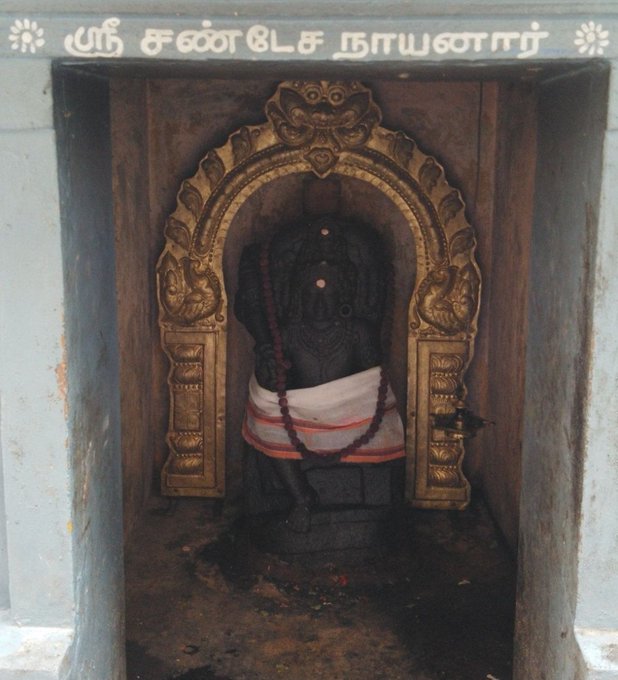
Chandeshwara/Chandikeshwara is regarded as custodian of Shiva Temple's wealth&most of Shiva temples in South India has separate sannathi for him.
His bhakti for Bhagwan Shiva elevated him as one of foremost among Nayanmars.
He gave importance to Shiva Pooja&protection of cows.
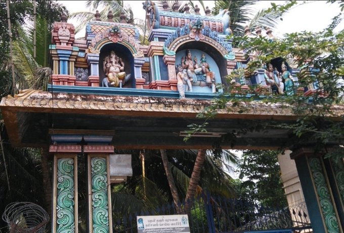
There are series of paintings, illustrating the #story of Chandikeshwar in the premises of
Sri Sathiyagireeswarar #Temple at Seinganur,near Kumbakonam,TN
Chandikeshwara's birth name
is Vichara sarman.He was born in the village of Senganur on the banks of River Manni.
His Parent names were Yajnathatan and Pavithrai.
Vichara Sarman was a gifted child and he learnt Vedas and Agamas at a very young age.
He was very devout and would always think about Bhagwan Shiva.
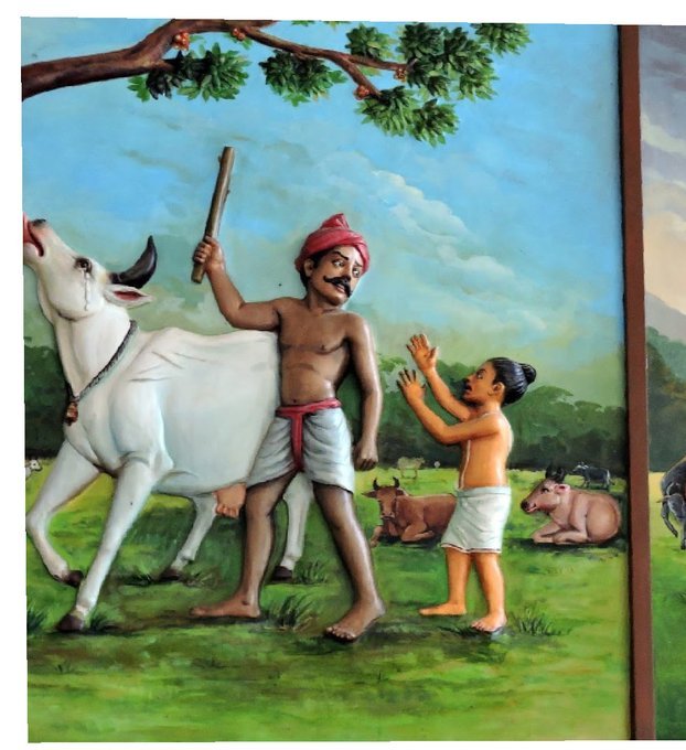
One day he saw a cowherd man brutally assaulting a cow,Vichara Sarman could not tolerate this. He spoke to cowherd: ‘Do you not know that the cow is worshipful & divine? All gods & Devas reside in https://t.co/ElLcI5ppsK it is our duty to protect cows &we should not to harm them.
Chandesha-Anugraha Murti - One of the Sculpture in Brihadeshwara Temple at Gangaikonda Cholapuram - built by Raja Rajendra Chola I
This Sculpture depicts Bhagwan Shiva along with Devi Paravathi blessing Chandeshwara - one of the 63 Nayanmars.
#Thread
Chandeshwara/Chandikeshwara is regarded as custodian of Shiva Temple's wealth&most of Shiva temples in South India has separate sannathi for him.
His bhakti for Bhagwan Shiva elevated him as one of foremost among Nayanmars.
He gave importance to Shiva Pooja&protection of cows.
There are series of paintings, illustrating the #story of Chandikeshwar in the premises of
Sri Sathiyagireeswarar #Temple at Seinganur,near Kumbakonam,TN
Chandikeshwara's birth name
is Vichara sarman.He was born in the village of Senganur on the banks of River Manni.
His Parent names were Yajnathatan and Pavithrai.
Vichara Sarman was a gifted child and he learnt Vedas and Agamas at a very young age.
He was very devout and would always think about Bhagwan Shiva.
One day he saw a cowherd man brutally assaulting a cow,Vichara Sarman could not tolerate this. He spoke to cowherd: ‘Do you not know that the cow is worshipful & divine? All gods & Devas reside in https://t.co/ElLcI5ppsK it is our duty to protect cows &we should not to harm them.


