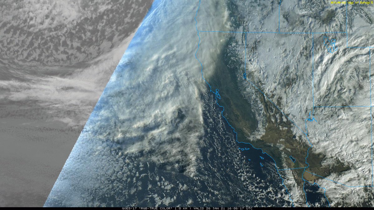
Thread on very strong inbound CA storm. A cold & clear morning will quickly give way to increasing clouds, NorCal valley rain & snow down to 1,500-2,000 ft (locally lower) later this PM. Current satellite imagery shows this strengthening system off the coast. (1/10) #CAwx
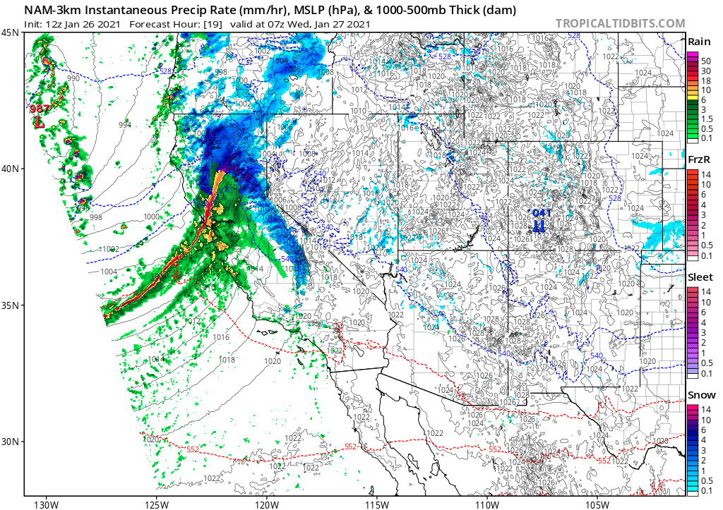
Tonight, a rapidly intensifying cold front will sweep across NorCal. This front will be unusually well defined, for a CA winter storm, and will replace an already cold airmass with...another cold airmass! (2/10) #CAwx
The cold frontal passage is expected to be quite dramatic across NorCal in the overnight hours. A convective "narrow cold frontal rainband" (NCFR) will likely develop, which could bring a period of torrential rain or snow to many areas, as well as possible lightning. (3/10) #CAwx
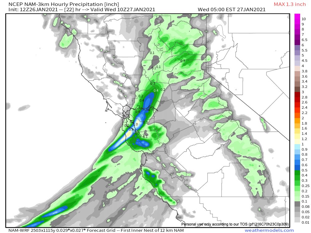
Extremely heavy precipitation is possible for a 30-60+ minute period when this NCFR feature moves ashore. Over an inch of rain could fall per hour in some spots. This portion of the event poses a high threat of debris flows in/near recently burned areas. (4/10) #CAwx
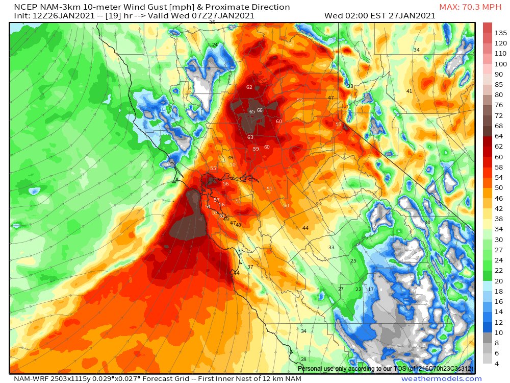
In addition to torrential rainfall, the cold front/NCFR will be accompanied by very strong wind gusts across much of NorCal. In fact, high-res models are suggesting potential for gusts of 60-70 mph even in lower elevation places. Widespread power outages possible. (5/10) #CAwx