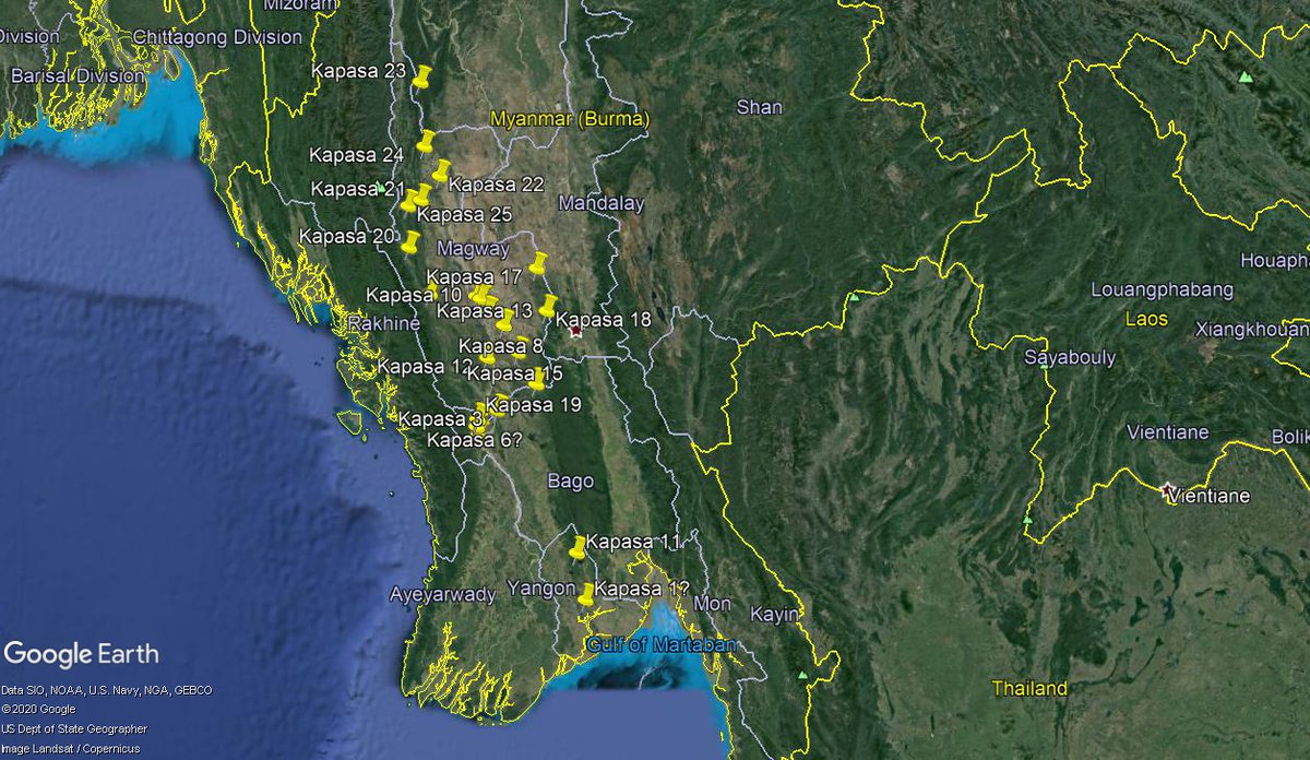
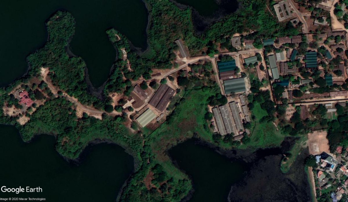
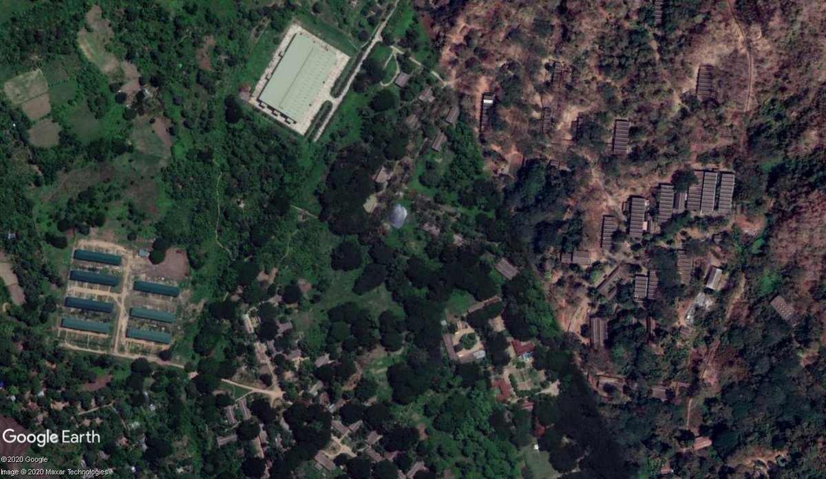
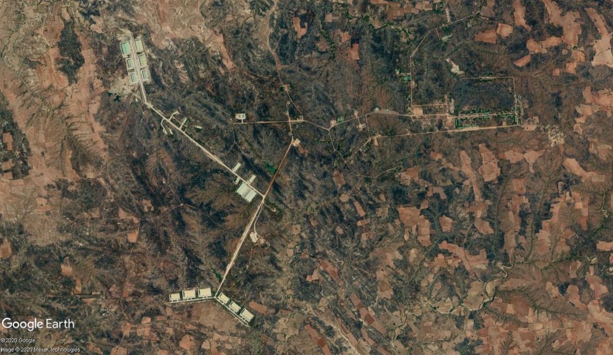
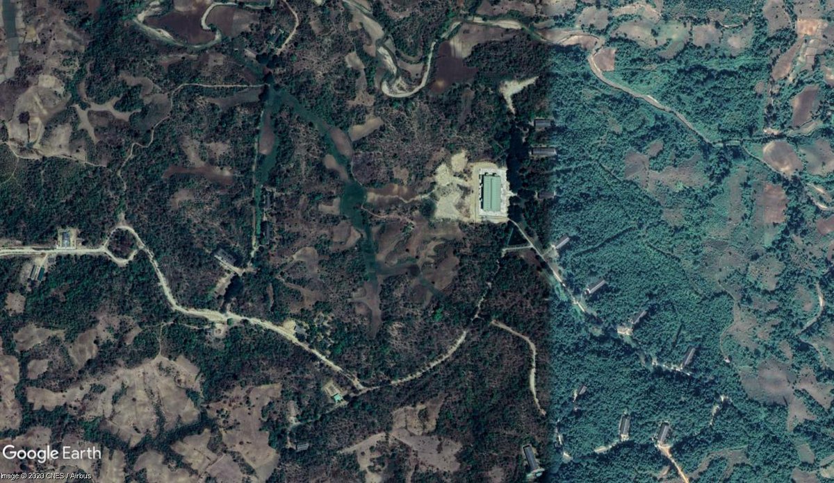
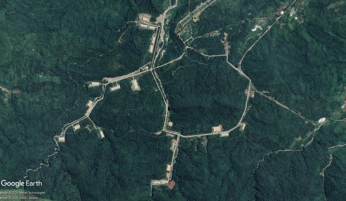
Merry Christmas everyone! What better way to distract yourself these days than a long thread about the largely unnoticed establishment of a vast military production infrastructure in Myanmar!
https://t.co/pOkUV5H7LS
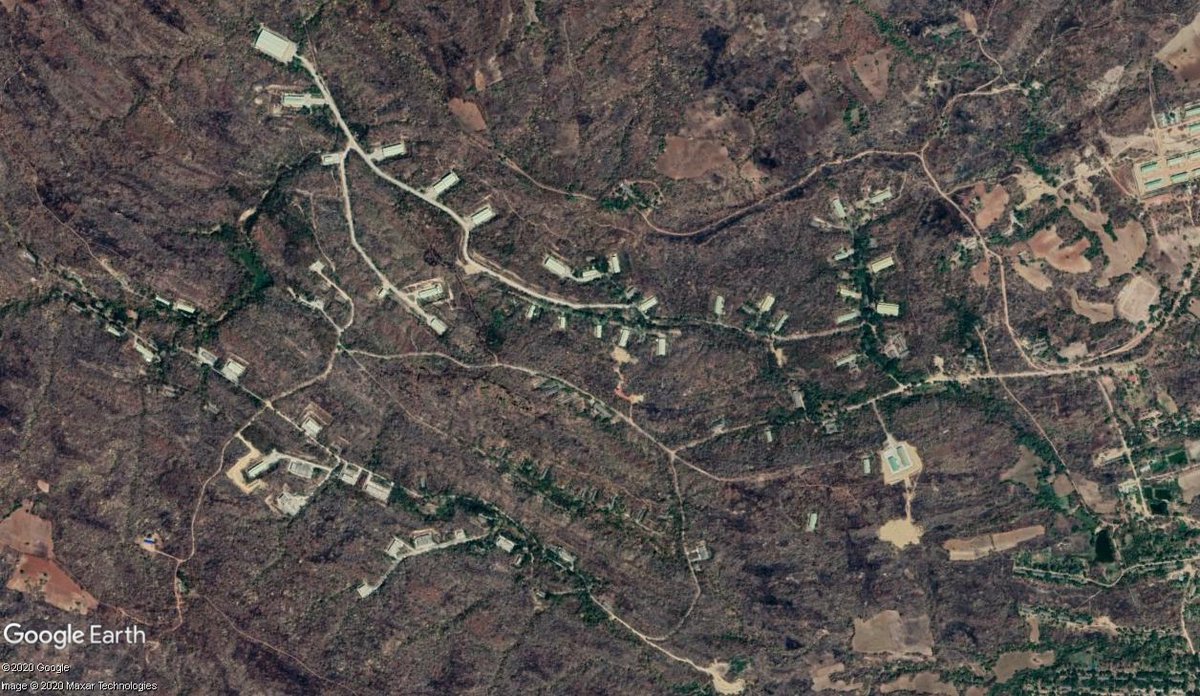
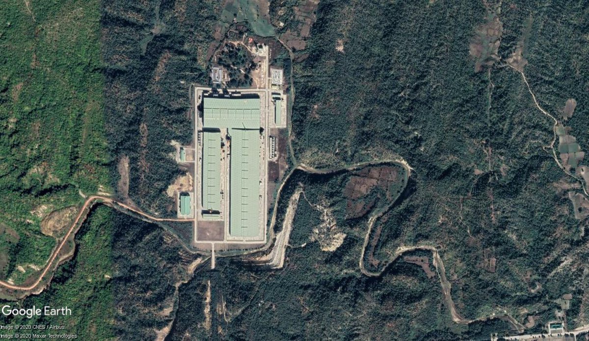
Potentially, the location of Ka Pa Sa 11. 17.326922° 96.059000°

https://t.co/G39GzLoo2E
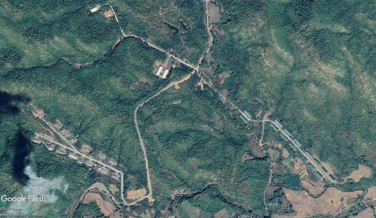

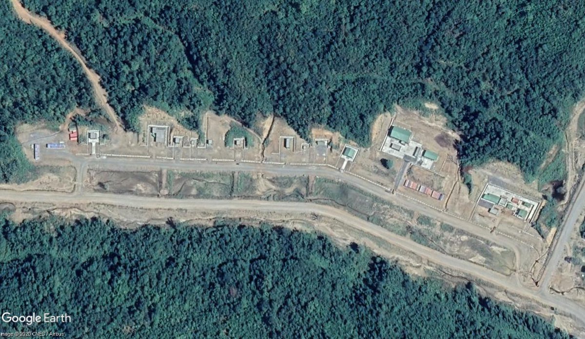
Ka Pa Sa 21, whose area stretches for almost 10km. 20.949352° 94.348304°

https://t.co/9LbfEnpELf
More from Government


You May Also Like


#Bookmark this
The full story of || Dhruv ||
We’ll see How Dhruv occupied a fixed position in the northern sky?
I repeat “Untold Unsung now Unearthed”
Go through entire thread carefully.
OM NAMO BHAGWATE VAASUDEVAAY
RT & spread the knowledge.
Any questions use #AskPratz

.... continuing from previous thread/story
O prince! Thus concentrate on that omnipotent eternal Lord with the mantra - ‘OM NAMO BHAGWATE VAASUDEVAAY’ .
https://t.co/H62ehDT3ix
The prince Dhruv greeted the sages and continued on his journey. At last, he reached a beautiful forest Madhuvan on the bank of the river Yamuna. It was the same forest, which was later occupied by a demon Madhu.

Shatrughana, the youngest brother of Sri Rama had killed demon Lavan, son of Madhu in the same forest & founded the township of Mathura. In the same forest, prince Dhruv decided to carry out his penance. As per the dictate of the sages, he began to recite the mantra continuously

Very soon, the earth began to move because of Dhruv’s severe penance. Even the seat of Indra could not remain stable. A stampede resulted among the gods. The gods then hatched a conspiracy to disturb the penance.

The full story of || Dhruv ||
We’ll see How Dhruv occupied a fixed position in the northern sky?
I repeat “Untold Unsung now Unearthed”
Go through entire thread carefully.
OM NAMO BHAGWATE VAASUDEVAAY
RT & spread the knowledge.
Any questions use #AskPratz
.... continuing from previous thread/story
O prince! Thus concentrate on that omnipotent eternal Lord with the mantra - ‘OM NAMO BHAGWATE VAASUDEVAAY’ .
https://t.co/H62ehDT3ix
So you too go and recite the same mantra in order to please Lord Vishnu.
— Prateechi \U0001f6eb\u2708\ufe0f\U0001f6e9\ufe0f (@BahuRaani) February 6, 2021
\u2026To be continued
It\u2019s a beautiful long story. Read it to your loved ones.
(Next Weekly Thread)
We\u2019ll see How Dhruv occupied a fixed position in the northern sky?
Stay Tuned
Jai Maa
_/\\_ pic.twitter.com/7TxdNsoZes
The prince Dhruv greeted the sages and continued on his journey. At last, he reached a beautiful forest Madhuvan on the bank of the river Yamuna. It was the same forest, which was later occupied by a demon Madhu.
Shatrughana, the youngest brother of Sri Rama had killed demon Lavan, son of Madhu in the same forest & founded the township of Mathura. In the same forest, prince Dhruv decided to carry out his penance. As per the dictate of the sages, he began to recite the mantra continuously
Very soon, the earth began to move because of Dhruv’s severe penance. Even the seat of Indra could not remain stable. A stampede resulted among the gods. The gods then hatched a conspiracy to disturb the penance.

So it's now October 10, 2018 and....Rod Rosenstein is STILL not fired.
He's STILL in charge of the Mueller investigation.
He's STILL refusing to hand over the McCabe memos.
He's STILL holding up the declassification of the #SpyGate documents & their release to the public.
I love a good cover story.......
The guy had a face-to-face with El Grande Trumpo himself on Air Force One just 2 days ago. Inside just about the most secure SCIF in the world.
And Trump came out of AF1 and gave ol' Rod a big thumbs up!
And so we're right back to 'that dirty rat Rosenstein!' 2 days later.
At this point it's clear some members of Congress are either in on this and helping the cover story or they haven't got a clue and are out in the cold.
Note the conflicting stories about 'Rosenstein cancelled meeting with Congress on Oct 11!"
First, rumors surfaced of a scheduled meeting on Oct. 11 between Rosenstein & members of Congress, and Rosenstein just cancelled it.
Rep. Andy Biggs and Rep. Matt Gaetz say DAG Rod Rosenstein cancelled an Oct. 11 appearance before the judiciary and oversight committees. They are now calling for a subpoena. pic.twitter.com/TknVHKjXtd
— Ivan Pentchoukov \U0001f1fa\U0001f1f8 (@IvanPentchoukov) October 10, 2018